Kevin
Tilton and I are both working on running in every town in New Hampshire
I came
up with an aggressive agenda that included four runs in 10 towns. It was aggressive because I’ve only been
running for a month and it would be a 17 mile day.
We met
up at 6:30am in North Conway and headed north
to our first destination. We reached the
Imp trail at 7:30am in just about ideal conditions. Temperatures were in the mid-40’s and the sky
was clear. Our goal was the “Imp Face” a
2.2 climb gaining 1,900’ and giving us a run in both Martin’s Location and
Bean’s Purchase.
We
headed into the woods as it was just getting light enough to run. The trail was pretty nice although a bit
difficult to watch were you were stepping due to all of the downed leaves. The climb went by quicker than I expected and
we reached the top where there was a great view of some of the Presidential
range right in front of us. The view of
the Auto
Road
We took
a couple of pictures then loped back down to the car.


Imp Face
- up 37:07, on top 2:17, down 35:07 =
Total 1:14:32
Then it
was off to Jefferson Notch road where we got in an easy 4 mile run (33:15) that
got us the towns of Randolph, Jefferson, and Low&Burbanks. Jefferson Notch road was commissioned in 1903
as the highest maintained New
Hampshire

30
minutes later we were over the top of the road and parked at the aptly named
Boundary Line trail. This short trail
(.9) is one that KT hadn’t run on before so we modified our run and did a neat 4
mile loop. The first .9 was on the
Boundary trail which was very interesting and very green. It really looked more like a trail in the
Pacific Northwest .

From the
trail we dropped down Base station road as we ran through Chandlers Purchase and
Beans Grant. Most of the 600’ of climb
we had during this run was climbing back to the car on Jefferson Notch
road. The four miles took us
43:03.
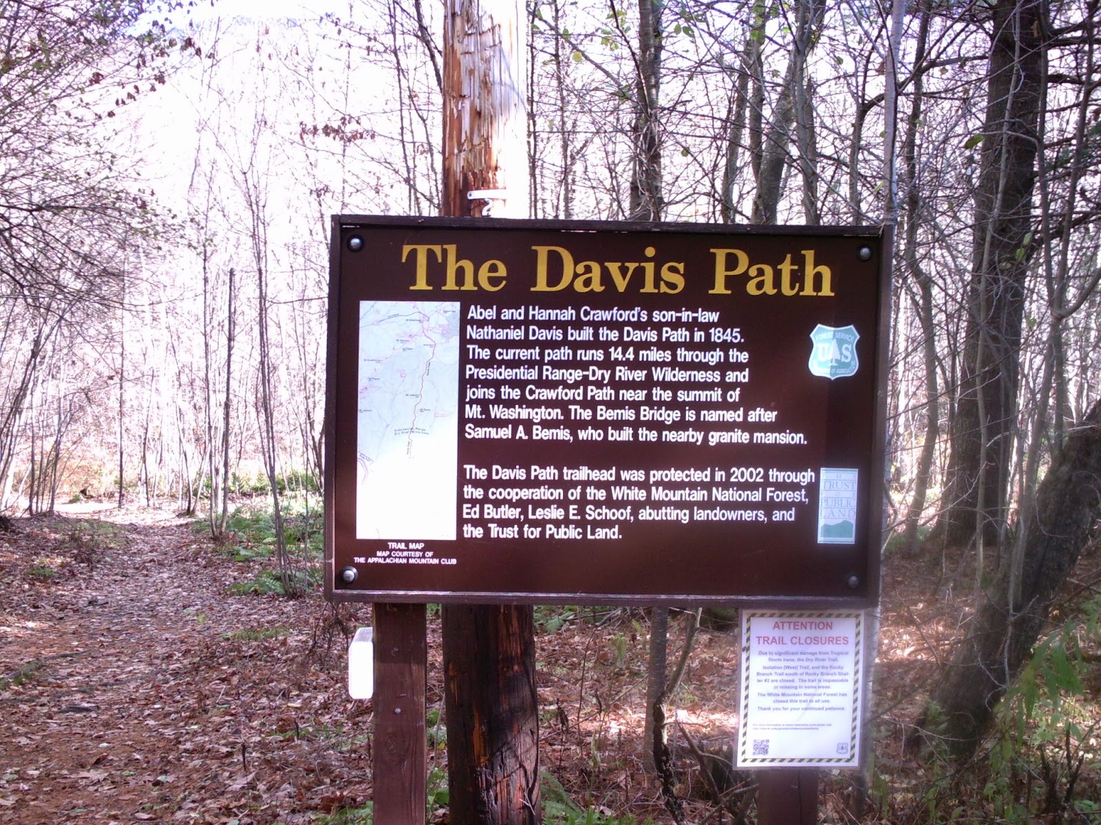
Our
fourth and final run of the day (11:30 am) was the Davis Path up/down Mt
Crawford. This would get us the towns of
Harts Location and Hadley’s Purchase. I
was already pretty tired from the previous 12+ miles and 2,600’ of climb and
descent. The trail was in great shape
and we ran into a few groups of hikers who offered encouragement.


We
reached the top in 41 minutes and then soaked in the scenery. The view was impressive! Then we picked our way carefully back to the
bottom.
4.4 m Mt
Crawford (2100’ climb/descent) = up 41:30, on top 6:52, down 38:48 –
1:27:10
What a
great day to be out in the White Mountains
bagging towns and visiting peaks!
No comments:
Post a Comment