Red Lining
Last Sunday I headed out to
Ashfield MA to visit more Trustees of the Reservations. I’m closing in on
100 Reservations and 500 miles of running. It should take me about 600
miles to run every step of every Reservation. I did not do much in August
but have big plans for September. The four Reservations I went to were
all pretty small, so I was able to complete them all while only running 11
miles. I don’t have many small ones left!
I was up at 430am and on
the road 15 minutes later. After a 2 hour drive (120+ miles) I emerged
from the car at Bullitt Reservation. It was nice and cool (50s) and there
was a steady breeze. I actually ran this one wear a long-sleeve t-shirt,
that is a big change from the hot and humid conditions we’d had recently.
The grassy fields were still a bit damp from the dew, but I managed to keep my
feet relatively dry while covering the 1.2 miles of trail. A quick 3 mile
drive got me to Chapel Brook. This reservation has a great mix of interesting
stuff. I started out running up the climbers trail to the top of Pony
Mountain (rough) then headed down the Summit trail (smooth), all that and I was
only ½ mile into it. Next was a great out/back run on the D.A.R.
trail. This featured some great footing and a lot of interesting
stonewalls and cellar holes. After that, I crossed the road and ran down
Chapel Falls road (dirt) and visited a couple of bridges on the aptly named
“Two Bridges” trail. Finally, I ascended on the blue trail with a couple
of side trails to views of Chapel Falls. That was a lot to pack into a
3.92 mile run. Another short drive (6m) got me to Bear Swamp. I
started with a run on the east side of the street to the Apple Valley Overlook
which had a nice view. Then I headed down Beaver Brook trail (pretty
rough) and the Fern Glad trail (pretty nice). The best trail was the
North-South which had few turns and decent footing. The highlight was the
view of Bear Swamp Orchard from the side trail. I got in 4.61 miles with
over 700’ of climb/descent. Since I had run less than 10 miles I decided
to add on Elliott Laurel on my way heading back East. I nearly missed it
since there isn’t a parking area and the sign has fallen down (or been
removed). The trails in the field were overgrown (although the
western-most one seemed to have been mowed recently). The trail from
intersection marker 1 to marker 4 doesn’t seem to exist anymore either. Actually
I never saw any of the intersection markers. It too 1.2 miles to cover
this very tiny (but nice especially in the hemlock section) reservation.
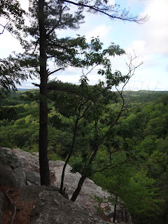
Pictures below:


No comments:
Post a Comment