My weekend began with a 2.5 hour drive north, and just as the sky was bright enough to read a map, I arrived at Blinn Hill in Dresden Maine. This was my first destination, a Maine county prominence point. I drove to the radio tower and walked around, there was no real view and nothing that was obviously the highest point. I probably spent less than 2 minutes and took off to Whitten hill. It was a quick 30 minutes to Sabattus Maine where I parked on the side of the road next to the radio tower. The wind had really picked up but temps around 30 and being only out of the car for 5 minutes made this another quick bag. That was my last pre-race destination so I headed off to Freeport for the XC race.

After finishing third at the Freeport XC race (story elsewhere) I jumped in the car and drove an hour to get Clark and Hosac. The two mountains are very close to each other and the height is nearly the same, so to claim the county high point it is standard practice to climb both. I parked on a quiet dirt road on the north side of Clark and ran up a logging road that climbs almost to the summit. It was a short bushwhack from the end of the road to the summit. I decided to head directly south and see if I could just cut cross-country to Hosac. It just seemed easier than back-tracking then hoping that the road wasn’t posted (no trespassing) further along.

I headed directly south and took a look at the cliffy area and thought "This is do-able". I took it very slowly working my way down in the slick oak leaf covered slope. About halfway down I took a big spill and nearly lost my camera (I was carrying just a camera and my car key). I cut up my hand and was bleeding on the map so I stopped and adjusted the camera and then continued down the slope. About 5 minutes later I realized that I no longer had my car key! I keep a spare under the car, but hadn't checked on it in 3 years...today would be the day. I hit the road and ran to the summit of Hosac, took some pictures and then ran the road back to the car. I had a few moments of panic after I got the key out and it wouldn't work in the door. It turned out to be the valet key and luckily I had nothing I needed in the trunk of the car so I was able to continue with my hikes.
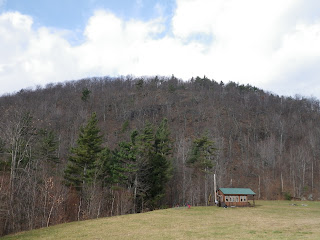 |
| Looking at the cliff section |
After Clark/Hosac I headed north and quickly found my way to Sebago ME and a big parking area for Douglas Mountain. I ran from the parking lot to the Ledges trail, took a few pictures from the top of the tower then ran down via the woods trail. It was a little more than 2 miles and I had the trail pretty much to myself, although this mountain gets a lot of traffic.
My sixth and final peak of the day was a late afternoon run up Shawnee Peak east to bag the north slope of Pleasant Mountain. I headed straight up the lift line then caught the trail to the summit and whacked for the county high point. The climb was pretty tough, I was definitely feeling tired. The top had some very nice open woods and there was a great view from the top of the ski slope. I tried to talk out loud pretty much the entire time I was out there. I didn’t see any hunters but I heard that the woods were teeming with “a bunch of idiots from out of state”.

The next morning Eric and I left his house at first light and headed to the southwest side of Camel’s hump. It was 20 degrees and sunny when we parked at the Burrows trailhead. Eric used running shoes with "an aggressive tread" and I went with Jalas (spiked orienteering shoes). This was going to be an easy day for me with just the 5 mile round trip as my only run of the day. We were hoping that it wouldn't be too icy. The first mile or so was great, and then it was a mix of snow and icy spots but nothing too bad. We hit the top in 53 minutes and stayed on top taking pictures for 6 minutes.
This was my final county high point in Vermont and I wanted some pictures. We were very cautious on the descent which ended up taking us another 1:01 (total time = 2:00:35). Conditions were great! No wind at all and temps in the teens on the top. We passed one hiker on the way up and there were about 15 people headed up as we ran down. This turned out to be a perfect morning for me to get my final county high point in Vermont!
Pictures: http://doubledmountainrunner.shutterfly.com/2282
Weekend totals:
21 miles running (including the XC race)
7 Peaks


1 comment:
How the heck did you lose your key. Safely tuck it away, mi amigo.
Post a Comment